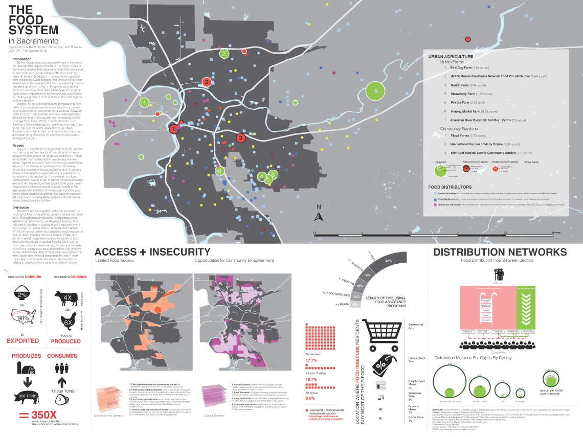
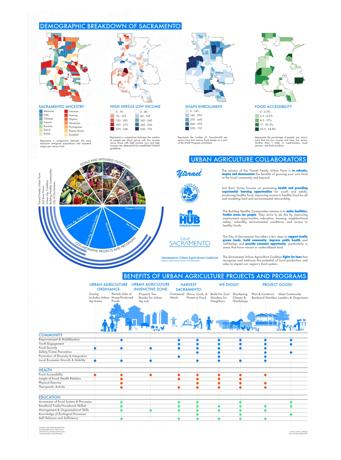
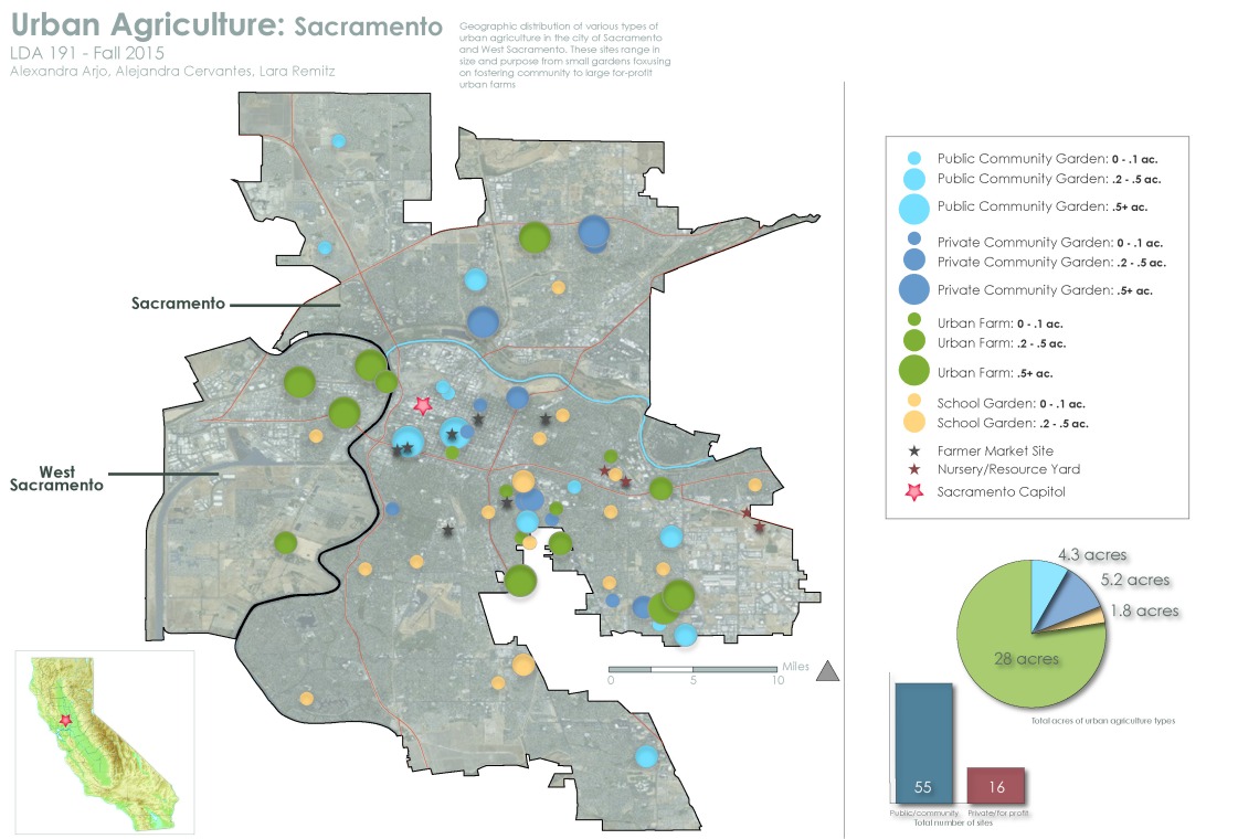
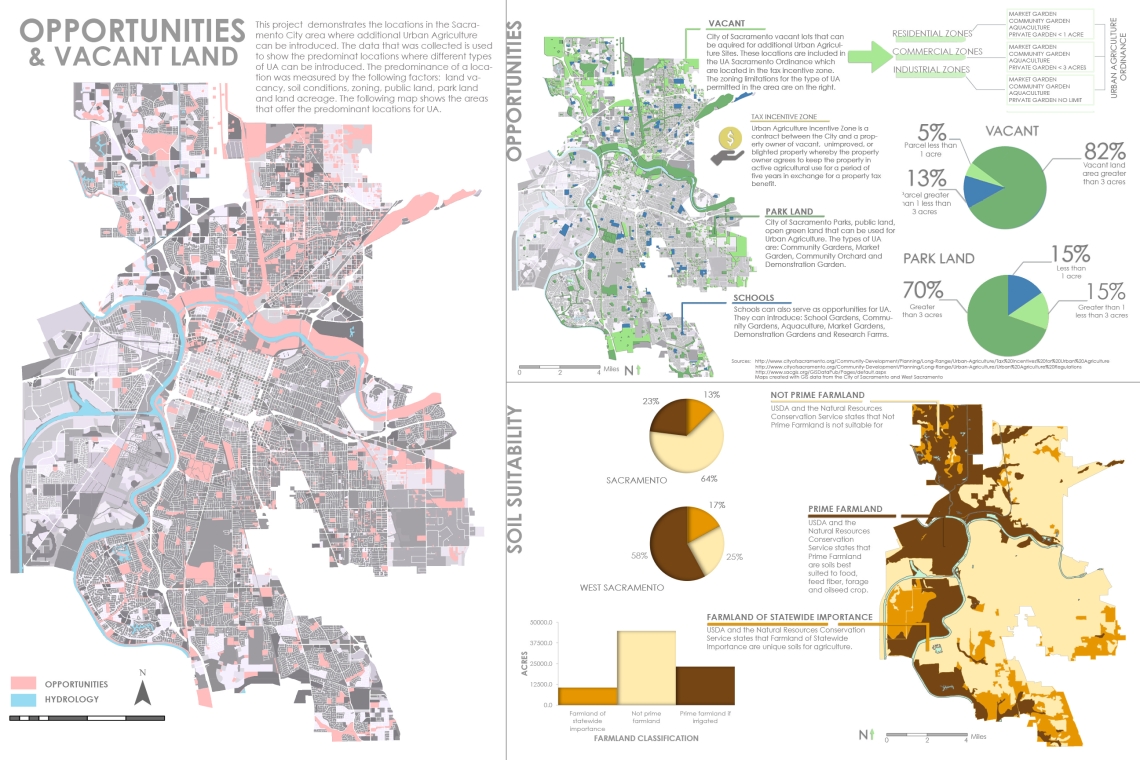
Working with students, community members and the Sacramento Urban Agriculture Coalition, we have been building an open source map that locates where urban agriculture projects are happening in the Sacramento region.
Additionally, students evaluated different types of urban agriculture and compiled case study precedents:


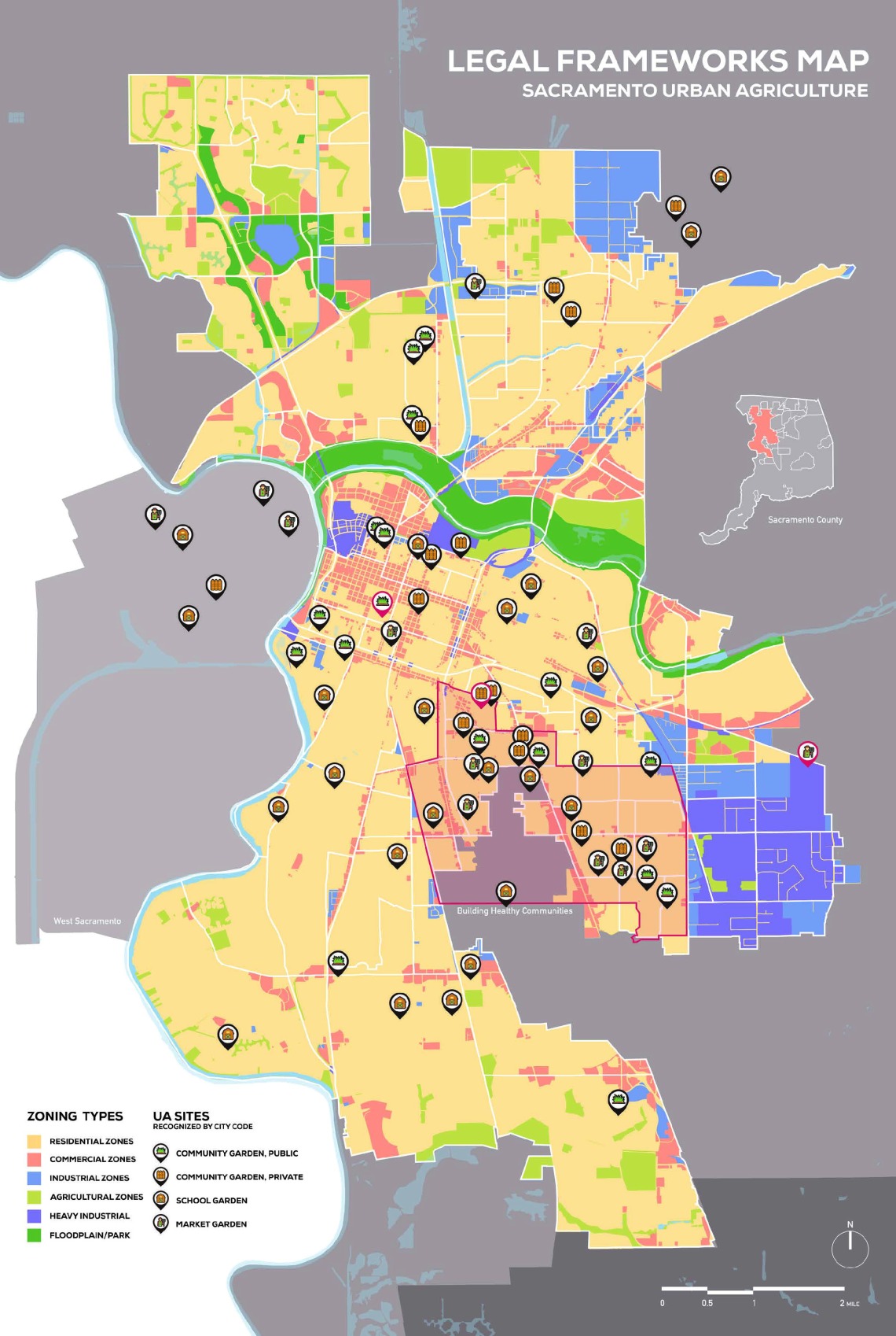
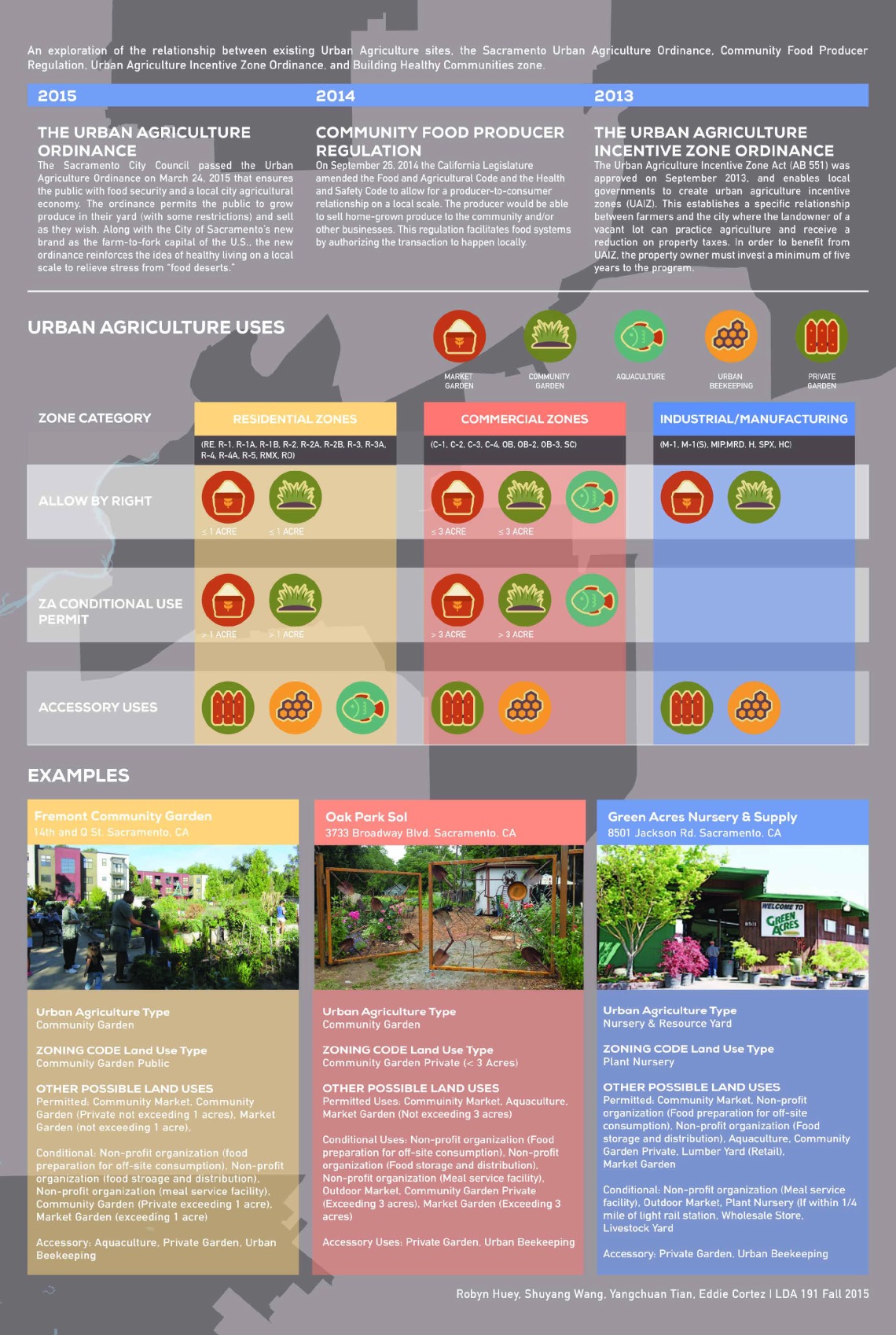
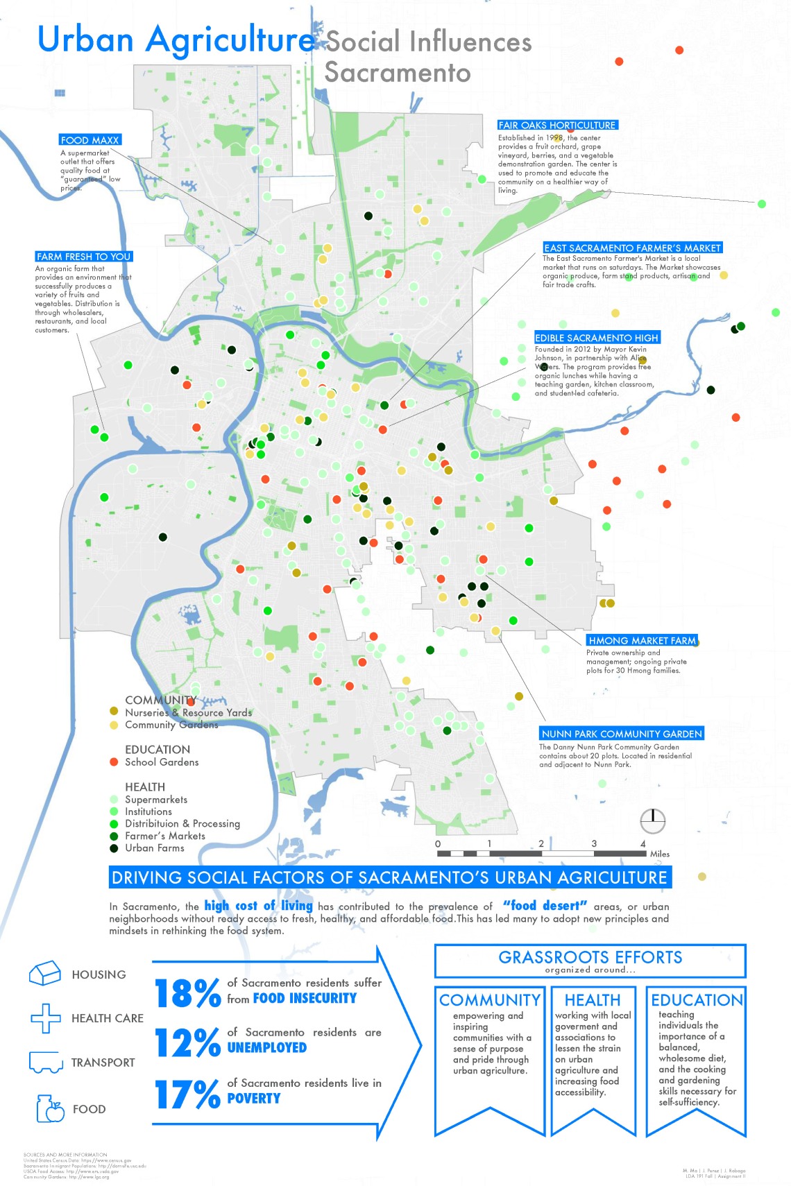
Working in GIS, students then sorted UA sites by category and assembled analytical maps of the Sacramento food system, including its legal, social and ecological dimensions: